| |
|
|
|
|
|
|
|
|
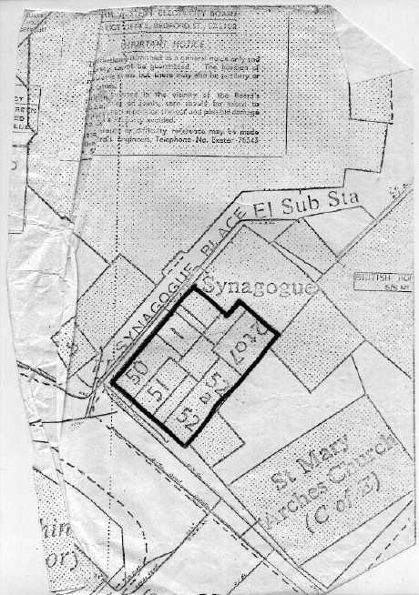
Exeter Synagogue on O. S. Map c.
1970
This O. S. Map used by the Electricity Board shows clearly the
name 'Synagogue Place', as well as the neighbouring properties that
were demolished to make way for Elm House. The synagogue, now an
isolated building, was originally built in on three sides.

Back
Home | About the Restoration | Holocaust Testimonies | Visit | History | Tour
|
|
About JCR-UK |
JCR-UK home page |
Contact JCR-UK Webmaster


Terms and Conditions, Licenses and Restrictions for the use of this website:
This website is
owned by JewishGen and the Jewish Genealogical Society of Great Britain. All
material found herein is owned by or licensed to us. You may view, download, and
print material from this site only for your own personal use. You may not post
material from this site on another website without our consent. You may not
transmit or distribute material from this website to others. You may not use
this website or information found at this site for any commercial purpose.
Copyright © 2002 - 2025 JCR-UK. All Rights Reserved


